 SoFla Guide Editors
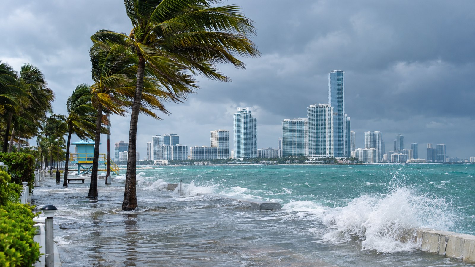
South Florida’s coastline is gearing up for another round of salty streets. WSVN 7News says king tides could bring minor to moderate coastal flooding around high tide starting midweek and running into the weekend of Oct. 24 to 25. CBS Miami has reportedly framed the weekend threat as moderate to major once heavy rain and strong winds join the party.
The short version: the coast is where the trouble is, high tide is when it shows up, and the forecast is still coming into focus.
How bad could it get?
Here is what’s confirmed. As of Oct. 20, strong northeast winds were keeping Atlantic seas at 8 to 12 feet, according to WSVN 7News, with a high rip current risk continuing through Thursday. That is not beach-day weather, no matter how nice the sky looks.
WSVN 7News also reported that another round of strong northeast winds is possible the weekend of Oct. 24 to 25, with gusts of 30 to 40 mph, especially near the coast. Pair that kind of wind with king tides and you get water pushed right where nobody wants it.
The more dramatic forecasts come with an asterisk. CBS Miami reportedly says king tides, heavy rain and wind could cause moderate to major coastal flooding this weekend, but that severity level had not been confirmed by National Weather Service or National Hurricane Center advisories at the time of writing. WSVN 7News has also reportedly flagged growing concerns about heavy rain and coastal flooding for the weekend, though specific rain totals and flood severity have not been confirmed by the NWS.
So the confirmed range from WSVN is minor to moderate. Anything beyond that is a “reportedly” for now.
Where the water has shown up before
If you live near the water, you probably don’t need a reminder. Still, recent history offers a pretty clear guide to where king tides like to make an entrance.
During the Sept. 27 to 28 king tides, flooding submerged portions of the Hollywood Beach Broadwalk and soaked streets in Fort Lauderdale, Miami Beach and Hollywood, according to reporting from Local 10, WSVN and CBS Miami. Fort Lauderdale police shut down two miles of A1A. Broward’s Port Everglades tide station recorded its highest flooding since it was installed in 2018, surpassing levels from Hurricane Nicole in 2022.
Then on Oct. 1, the National Weather Service issued a flood advisory for parts of Miami-Dade and Broward as heavy rain combined with king tides, CBS Miami reported, and a coastal flood advisory was in effect for the Upper Florida Keys. A second king tide cycle followed Oct. 7 to 13, with CBS Miami reporting minor coastal saltwater flooding possible.
And yes, we’re not done. WFLA and iHeart Florida News reported earlier this month that another king tide period is forecast for Oct. 24 to 30, which lines up right on top of this weekend’s wind and rain concerns.
What about Invest 93L?
You may have seen headlines about a low off the East Coast possibly going subtropical. Here’s the deal.
The National Hurricane Center said that as of Oct. 20, a storm-force non-tropical low designated Invest 93L sat along a frontal boundary a few hundred miles off the North Carolina coast. The NHC gave it a 40 percent chance of subtropical or tropical development over seven days and expects it to stay offshore and move away from the U.S. East Coast by the end of the week, according to the NHC, ClickOrlando/WKMG and Fox Weather.
A meteorologist quoted by USA Today and the Tallahassee Democrat explained how it could get there: “Over the next few days as 93L loiters in the vicinity of the warm Gulf Stream waters, it may muster up enough organized thunderstorm activity near its circulation center to shed its remaining frontal features and acquire tropical characteristics.”
WPBF reportedly said the system could briefly turn subtropical. The NHC and other outlets confirm that potential but note Florida faces no direct impact from it.
The bigger point is that the label may not matter much. Regardless of whether 93L develops, the NHC said high winds, coastal flooding and dangerous surf are expected along portions of the U.S. East Coast over the next few days, per an Oct. 19 advisory cited by WJBF in Augusta, Georgia. The same meteorologist quoted by USA Today and the Tallahassee Democrat put it simply: “Regardless of whether or not the low does become a tropical or subtropical storm, expected impacts would remain the same.”
What’s next and who to follow
For South Florida, the main story this weekend is king tides plus northeast wind, with rain as the wild card. Keep an eye on high tide times, give the rough surf plenty of respect, and don’t assume a flooded street from last month will behave any better this time.
For official updates, follow the National Hurricane Center for anything involving Invest 93L, and your county emergency management office in Miami-Dade, Broward, Palm Beach or Monroe for local flooding guidance. The National Weather Service is the source for any coastal flood or flood advisories as the weekend gets closer.
We’ll keep watching the water so you don’t have to refresh your weather app every five minutes. Okay, fewer than every five minutes.