 SoFla Guide Editors
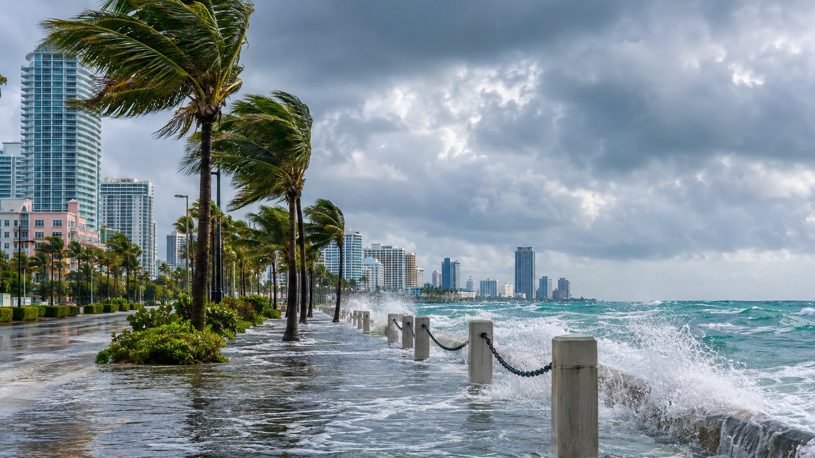
Pack your patience along with your umbrella, South Florida. King tides, heavy rain and gusty winds are lining up for a soggy weekend on the east coast, and the worst of it looks like Sunday into early next week. CBS Miami’s NEXT Weather team says moderate to major coastal flooding will be possible, so plan around high tide and don’t drive through standing water.
How bad could the flooding get?
Forecasters are not shrugging this one off. A coastal flood advisory covers the east coast of South Florida, including Miami-Dade, Broward and Palm Beach counties, through at least this weekend. That’s according to the National Weather Service Office Miami-South Florida, as reported by the USA TODAY Network and the Palm Beach Post. The weather service flagged a risk of moderate coastal flooding.
CBS Miami reported that as of October 22, a coastal flood advisory was in effect for Miami-Dade, Broward and the Upper Keys. A coastal flood statement covered the Middle and Lower Keys.
The weather service’s advisory text was blunt about what to expect: “Flooding of lots, parks, and roads.” Translation: the parking lot you always use might be a pond for a few hours.
The big worry is what happens when the rain shows up at the same time as the tides. The NWS Miami forecast put it this way: “Any heavy rain combined with higher astronomical tides could lead to more significant coastal flooding.”
The South Florida Water Management District’s October 19 forecast, which runs through October 27, said tidal water levels along the east coast could exceed the weather service’s “Minor Flooding” threshold in the coming days. It added that levels could approach the “Major Flood” threshold late in the forecast period, according to the USA TODAY Network and the Palm Beach Post.
CBS Miami issued a NEXT Weather Alert from Sunday through Tuesday. The station cited heavy rain, localized flooding, gusty winds and higher-than-normal king tide flooding, which it said will peak late this weekend into early next week.
The rain and wind setup
This isn’t just a tide story. It’s a tide, rain and wind combo platter.
The Weather Prediction Center placed most of South Florida under a Level 2 (Slight) risk of excessive rainfall on Sunday, with a slight risk of flash flooding, CBS Miami reported.
WSVN 7News reported that an upper-level low near South Florida will bring rounds of heavy rain Saturday through Monday. The station said East Coast metro areas could see 1 to 3 inches, with 4 to 6 inches possible in spots. The weather service’s own forecast called for 2 to 4 inches, according to the USA TODAY Network.
Rain chances climb as the week goes on. The NWS forecast had them at 40% Thursday, 50% Friday, 70% Saturday and 80% Sunday, the USA TODAY Network reported.
“The wet weather is really going to ramp up as we head into the weekend,” CBS News Miami meteorologist Lissette Gonzalez said, as quoted by the USA TODAY Network.
Then there’s the wind. WSVN 7News said northeast winds could gust 25 to 35 mph Saturday and 30 to 40 mph Sunday. CBS Miami said gusts could hit 30 to 40 mph or stronger Sunday into Monday.
Beaches and boaters, take note
If your weekend plan was a beach day, maybe reschedule. WPLG Local 10 reported that the strongest winds should arrive Sunday, kicking up dangerous surf with large breaking waves of 5 to 8 feet. The station said that during high tide, most of South Florida’s beaches will be covered with water, and significant saltwater flooding is possible.
The weather service also warned of rough conditions for boaters and swimmers along the coast, according to the USA TODAY Network. The fishing trip can wait.
When to stay off the roads
Here’s the practical part. The heaviest rain, the strongest winds and the peak tide flooding are all expected to stack up from Sunday into early next week, based on the forecasts from CBS Miami, WSVN 7News and WPLG Local 10. That window is when flooded streets are most likely, especially in low-lying coastal neighborhoods and especially around high tide.
The weather service’s advice is simple: don’t drive through water of unknown depth. Saltwater and car engines are not friends, and that puddle could be a lot deeper than it looks.
A few smart moves before the weekend:
- Check high tide times for your area and plan errands around them.
- Move your car to higher ground if your street tends to flood.
- Give yourself extra time on Sunday and Monday commutes, or skip unnecessary trips.
- Stay off the beach and out of the water while the surf is rough.
Who to follow for updates
Forecasts can shift, and the weather service has been updating its advisories as the weekend approaches. For official updates, follow the National Weather Service Office Miami-South Florida, the National Hurricane Center and your county’s emergency management office in Miami-Dade, Broward, Palm Beach or Monroe.
Nobody’s saying panic. But this weekend, the ocean is going to be a little nosy about where it belongs, so give it some room.