 SoFla Guide Editors
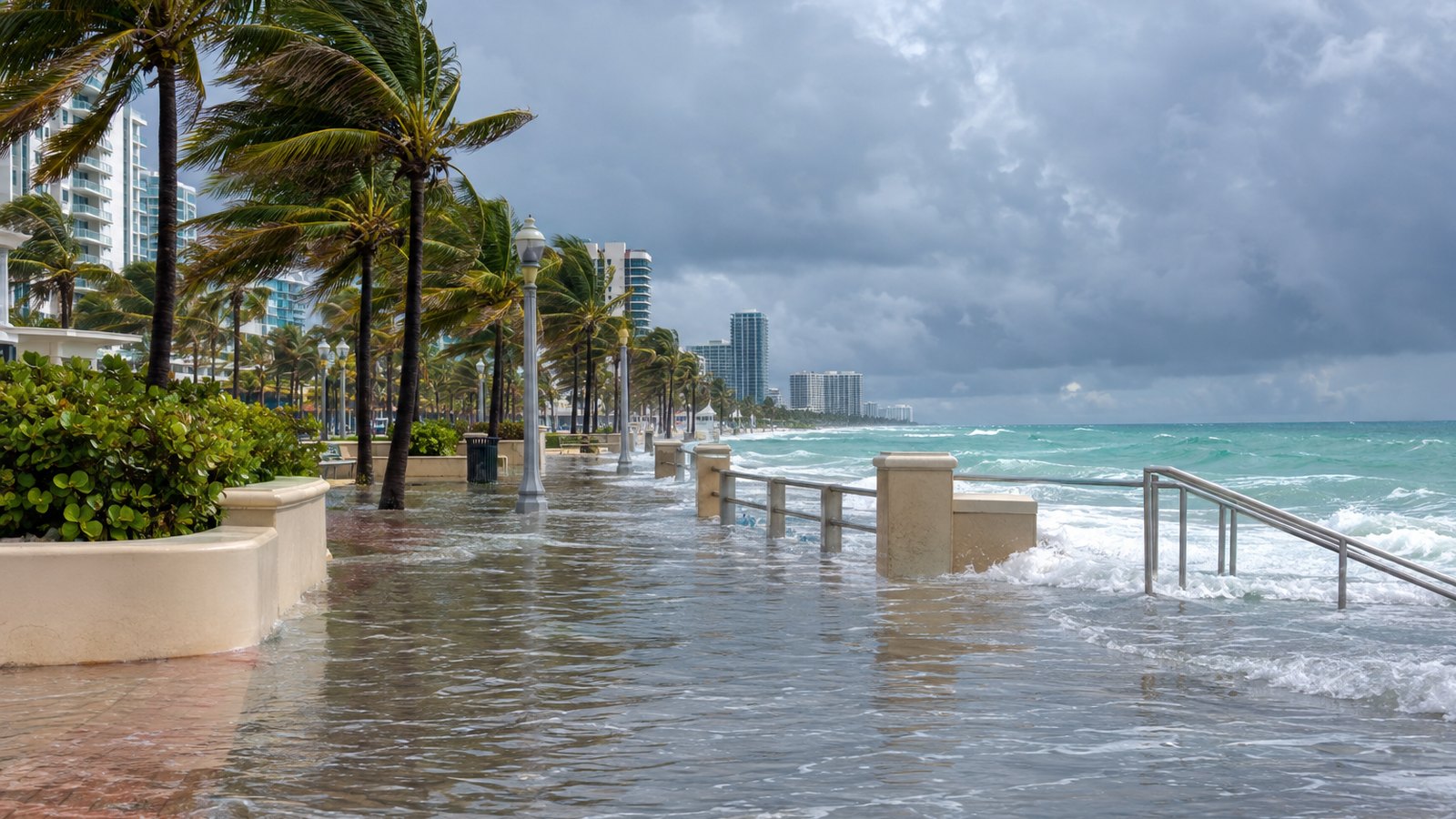
The water that put the Hollywood Broadwalk under several inches of saltwater last month is coming back, and forecasters say this round could be worse. The City of Hollywood expects the highest water levels from October 26 to 28. The National Weather Service warned the setup could push flooding past current moderate flood projections. As for Post-Tropical Cyclone Josephine, the storm everyone is side-eyeing, other outlets report it is heading away from the U.S.
What’s coming, and when
The National Weather Service issued a coastal flood advisory for South Florida on Thursday, October 22, with rain and king tides both in the forecast, CBS Miami reported.
The City of Hollywood got ahead of it. On October 20, the city issued an official alert warning of elevated flooding potential from October 22 through October 31. The peak is expected October 26 to 28, lining up with the October 26 full moon, persistent strong onshore winds and forecast weekend showers.
That combination is the real story. According to the National Weather Service, as cited by the city, the full moon, the winds and the rain together could produce flooding that exceeds current moderate flood projections.
The South Florida Water Management District’s October 19 forecast warned that tidal levels could approach the “Major Flood” threshold by late in its October 22 to 27 forecast period.
Rain is the other half of the problem. CBS Miami reported that the Weather Prediction Center issued a Level 2 out of 4 excessive rainfall risk for Saturday, October 24, particularly along portions of Florida’s Atlantic coast. The CBS News Miami NEXT Weather team also issued a NEXT Weather Alert for Sunday through Tuesday because of heavy rain, gusty winds and elevated king tides.
“The wet weather is really going to ramp up as we head into the weekend,” CBS News Miami meteorologist Lissette Gonzalez said.
So where does Josephine fit in?
A CBS Miami headline reportedly framed Post-Tropical Cyclone Josephine as combining with king tides and heavy rain to directly threaten South Florida’s coast this weekend. Other reporting points the other way. CBS12 in West Palm Beach and WFTV both report that Josephine is moving away from the U.S., with no direct South Florida impact and no watches or warnings in effect.
The National Hurricane Center classified Josephine as post-tropical on October 22, with its center well north of Florida and moving northeast. Translation: the flooding risk here comes from the moon, the wind and the rain, not a storm making a beeline for Broward.
Hollywood has seen this movie before
Late September offered a preview. That round of king tides flooded streets in Fort Lauderdale, Miami Beach and Hollywood, WSVN 7News reported. Fort Lauderdale police shut down two miles of A1A, and the Hollywood Broadwalk sat under several inches of saltwater.
Residents remember it well.
“The City of Hollywood did a great job cleaning this up. But I walked through 6 inches to a foot of water all the way up and down the Broadwalk,” Hollywood resident Grace Moore told Local10.
Some locals treat king tides as part of the calendar, like stone crab season, only soggier.
“If you live here in Hollywood, we expect them, we know they’re coming, we know it’s four times a year,” Hollywood resident Dan Kennedy told Local10.
For people who live on the lowest streets, it’s not just a nuisance. Doris Edelman, a Hollywood homeowner of 50 years, described the reality to CBS Miami.
“When the tide is high and the street is about 8 inches deep it’s very difficult to get in and out of the street and sometime you can’t go out at all,” she said.
King tides are the highest predicted tides of the year, driven by the alignment of the sun, moon and Earth, and they show up several times a year in South Florida. The city’s Tidal Flooding Mitigation Project includes removable storm panels at seawall openings, tiger dams along the Broadwalk and tidal gate panels in the South Lake area.
What to do this weekend
The practical playbook is simple, and none of it involves panic:
- Watch the calendar. October 26 to 28 is the window Hollywood flagged for the highest water, with elevated flooding possible through October 31.
- Skip the saltwater. Driving through flooded streets is rough on cars, and saltwater is especially unkind to undercarriages. If a road like A1A gets closed, as it did in September, take the detour.
- Plan around high tide. If your street floods, time errands and appointments so you’re not stuck at home, or stuck trying to get back.
- Expect rain on top of tides. Saturday’s excessive rainfall risk and the Sunday through Tuesday alert mean water can pool even away from the beach.
For official updates, follow the National Weather Service, the National Hurricane Center and your county emergency management office. Hollywood residents should also keep an eye on alerts from the City of Hollywood. If a flood warning replaces the advisory, those are the people who will tell you first.