 SoFla Guide Editors
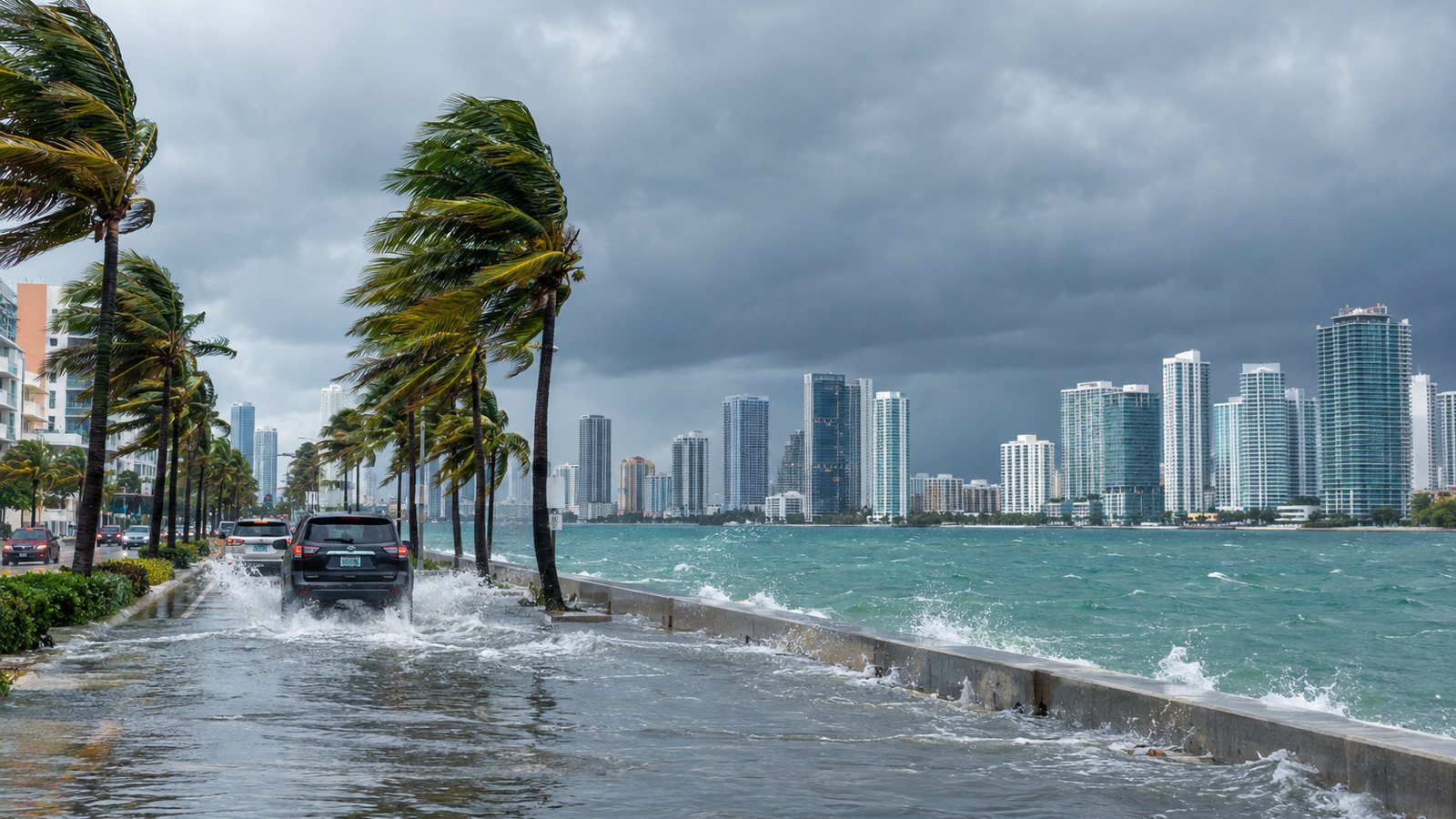
The king tides didn’t wait for the weekend. Streets and neighborhoods across Miami-Dade and Broward were already taking on water Friday, WSVN 7News reported, from Northeast 79th Street in Miami up to the pier in Dania Beach. Sunday looks like the roughest day, with forecasters calling for northeast gusts of 30 to 40 mph, the heaviest rain of the weekend and a coastal flooding threat that sticks around into early next week.
“The king tide takeover has begun and has already hit vulnerable spots across South Florida,” a WSVN 7News reporter said on air.
Where the water is right now
King tides caused significant flooding on roads and in residential areas across both counties on Friday, October 23, according to WSVN 7News.
In Miami, the station reported that the roadway just off Northeast 79th Street had inches of water across it Friday morning. A few blocks away, near Northeast 10th Avenue and 80th Street, water covered the streets in every direction. Orange cones were set out to mark which way the road went, which tells you how much of the pavement was still visible.
Broward got soaked too. WSVN 7News reported that king tides hit parking lots, roads and apartment complexes in Hallandale Beach off Ocean Drive, in Hollywood, and in Dania Beach near the pier.
A quick refresher if you just moved here: king tides are the highest predicted high tides of the year. They happen when the gravitational pull of the sun and moon lines up, and they come back in predictable annual cycles along South Florida’s Atlantic coast.
This fall has already been a busy one. During the king tide weekend of September 27 and 28, a flooding record fell at Broward’s Port Everglades tide station, the highest reading since the station was installed in 2018 and higher than during Hurricane Nicole in 2022, Hoodline reported, citing the Miami Herald. CBS Miami reported that king tides combined with heavy rain flooded streets in Broward and Miami-Dade again on September 29, with some cities hit for the second week in a row. CBS Miami also reported that the National Weather Service issued a flood advisory for both counties on October 1 during another round of tides and rain.
How bad will Sunday get?
Short version: windier, wetter and higher water, especially around high tide.
WSVN 7News meteorologists forecast northeast wind gusts of 25 to 35 mph on Saturday, climbing to 30 to 40 mph on Sunday. They expect moderate coastal flooding around high tide later in the weekend.
CBS Miami’s NEXT Weather team issued a NEXT Weather Alert running from Sunday through Tuesday. The station cited potential heavy rain, localized flooding, gusty winds and higher-than-normal king tide flooding peaking late this weekend into early next week, and said moderate to major coastal flooding is possible. CBS Miami also reported that gusts could reach 30 to 40 mph or stronger from Sunday into Monday.
Then there’s the rain. WSVN 7News forecast 3 to 6 inches from Friday through Monday across the East Coast metro areas, with isolated higher totals possible. The station said the setup comes from an upper-level low near Cuba paired with strong high pressure to the north. WSVN 7News expects Sunday to be the wettest day of the weekend and advised caution on the roads.
Saturday isn’t exactly a beach day either. The Weather Prediction Center placed Southeast Florida under a Level 2 of 4, or Slight Risk, for excessive rainfall on Saturday, October 24.
Rain falling on streets that are already holding tidewater has nowhere fast to go, so spots that flood on a sunny king tide morning are the ones to watch most closely.
What’s next, and who to follow
This isn’t a one-and-done weekend. NOAA and the National Weather Service forecast the current king tide cycle to run from October 24 through October 30, with peak tides on October 27 along the Atlantic coast and on October 28 and 30 in the Florida Keys. So even after the rain moves on, high tide could keep pushing water into the usual trouble spots for several more days.
The National Weather Service in Miami has issued a Coastal Flood Advisory for coastal Miami-Dade and coastal Broward.
A few practical moves for the next several days:
- Check the tide times before you head out, and plan routes that skip the low spots near the bay and the Intracoastal.
- Give yourself extra time on Sunday, when the heaviest rain and strongest gusts are expected.
- Don’t drive through standing water. It’s often deeper than it looks.
- Secure patio furniture and anything else that could catch a 40 mph gust.
For official updates, follow the National Weather Service in Miami, plus the Miami-Dade and Broward County emergency management offices. For anything tropical, the National Hurricane Center is the source to watch. We’ll keep an eye on the water too, and update as the forecast changes.