 SoFla Guide Editors
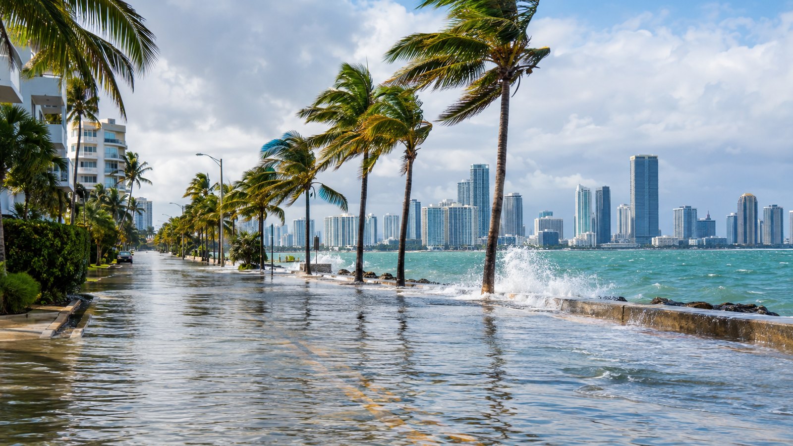
If your street already looks like a canal, brace yourself: this is only the warm-up. King tides are flooding South Florida roads right now, and CBS Miami reported that the highest predicted tide arrives Tuesday morning, October 27. Rain and gusty northeast winds are expected to make things soggier through Tuesday.
Where it’s flooding right now
Moderate flooding had already been showing up with each high tide as of Saturday, October 24, CBS Miami reported. The station put a NEXT Weather Alert in effect Sunday through Tuesday for ongoing high-tide flooding made worse by heavy rain and a strong northeast wind.
The National Weather Service in Miami issued a Coastal Flood Warning at 7:43 a.m. Sunday, October 25, for Coastal Palm Beach County, which includes Boynton Beach. The warning runs until 8 p.m. Tuesday. The NWS said moderate coastal flooding is expected around high tide, reaching major flood stage on Monday and Tuesday.
The NWS warning doesn’t mince words. It says numerous roads may be closed, and that low-lying property, including homes, businesses and some critical infrastructure, will be inundated. The agency also warned of dangerous surf with breakers of 8 to 10 feet and life-threatening rip currents. This is not a beach day.
Boynton Beach knows this drill. The city’s official website says some areas sit less than 2 feet above sea level, which makes them especially vulnerable during seasonal high tides. The city says it has installed tidal valves in affected neighborhoods to reduce the impacts.
Farther south, Local10 reported Saturday that a Coastal Flood Advisory was in effect for coastal Broward and Miami-Dade counties, with moderate to major flooding expected into Monday as winds picked up and on-and-off downpours moved through. By Sunday, CBS Miami reported that a coastal flood warning was in effect for South Florida’s east coast, with major flooding expected around high tides.
The Upper Keys are getting it too. NWS Key West issued a Coastal Flood Warning at 4 a.m. Sunday for the Upper Florida Keys, citing major saltwater flooding. That warning runs until 5 a.m. Monday.
The Miami Herald also reportedly said South Florida is already flooding with the peak of the king tide still days away.
Why the water isn’t going anywhere
Wind is the troublemaker here. CBS Miami reported that a strong northeast wind was set to develop Sunday afternoon and gust near 40 mph each afternoon through Tuesday. That wind pushes more water up against the coast and keeps water in the Intracoastal and bay areas from draining between high tides. So instead of getting a breather between tides, the water just kind of hangs around like a houseguest who won’t leave.
A gale warning is also in effect through Tuesday, with sustained gale-force winds of 39 to 54 mph, according to CBS Miami.
Then there’s the moon. CBS Miami reported that the full moon falls on Monday, October 26, with the highest predicted tide coming the next morning.
Rain timing matters a lot. Fort Lauderdale Chief Resiliency Officer Dr. Nancy Gassman explained it to CBS Miami: “The key will be the timing of the rainfall. If the rainfall is at the same time as the high tide, we’ll expect much wider spread flooding throughout the roadways.”
She also set expectations high, literally. “Over the course of the weekend and into next week, especially through Tuesday and Wednesday, we’re expecting tides higher than we’ve ever seen,” Gassman told CBS Miami.
How cities are getting ready
CBS Miami reported that municipal officials and residents were preparing for potentially widespread flooding as king tides peaked and heavy rain and strong onshore winds threatened the region.
In Hollywood, the focus is on pumps. “We’re monitoring the pumps. We’re making sure that they’re operational. They’re all operational right now. We have auxiliary pumps that have also been deployed, and those will be operational too,” city spokeswoman Joann Hussey told CBS Miami.
This isn’t the first round this fall. CBS Miami reported that numerous roads close to the coast were closed by king tide flooding over the weekend of September 27 and 28, and that businesses put out sandbags as a precaution.
What to do before Tuesday
Looking for sandbags? Sandbag sites and availability vary by city, so check directly with your city or your county emergency management office for current locations and hours.
A few common-sense moves until the water backs off:
- Don’t drive through flooded streets. Saltwater is rough on cars, and the NWS says numerous roads may close.
- Plan around high tide. Flooding is expected to be worst around those windows, especially Monday and Tuesday.
- Stay out of the ocean. The NWS is warning of 8 to 10 foot breakers and life-threatening rip currents along coastal Palm Beach County.
- Move your car to higher ground if you live in a spot that floods at high tide.
For official updates, follow the National Weather Service offices in Miami and Key West, the National Hurricane Center, and your county emergency management office. They’ll have the latest on warnings, road closures and when this soggy stretch finally drains away.